Council on Energy, Environment and Water Integrated | International | Independent
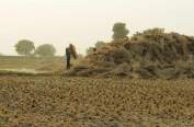
Challenge: India’s satellite-based stubble burning tracking often undercounts farm fires due to coarse spatial resolution, limited revisit times, and atmospheric interferences, affecting air quality forecasts and responses.
CEEW Analysis: High-resolution imagery revealed that sensors detected only seven out of 169 fires, while CEEW’s burnt-area algorithm using Sentinel-2 showed around 75 per cent accuracy, highlighting major gaps during peak burning season.
Way Forward: India must integrate multi-source satellite data to balance frequency, resolution, and coverage of farm fires.
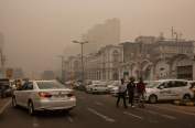
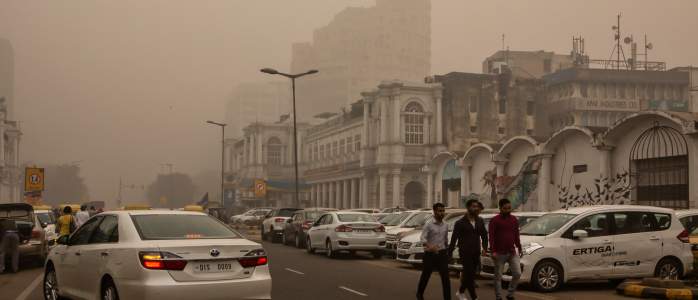
The AQI in Delhi crossed the ‘Severe’ category (AQI>400) on 10 November, and data from the Decision Support System showed that stubble burning was one of the major contributors. The average contribution from stubble burning was about 15 per cent between 10 November and 17 November.
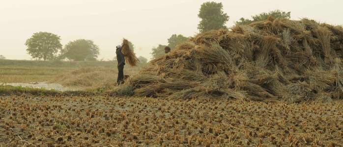
Central and state government agencies track farm fires every year to gauge how effective their interventions have been in curbing stubble burning. Tracking is also crucial because the Commission for Air Quality Management (CAQM) in the National Capital Region and adjoining areas imposes the Graded Response Action Plan (GRAP) based on air quality forecasts. The accuracy of these forecasts depends partly on how accurately the emissions from stubble burning are estimated.
Satellites have made it possible to monitor fires across large regions without painstaking field surveys. Yet, recent evidence suggests that they may not be giving us the full picture.
Satellite sensors detect fires in two ways:
The CAQM and other government agencies primarily rely on the Moderate Resolution Imaging Spectrometer (MODIS) and Visible Infrared Imaging Suite (VIIRS) for fire detection. These sensors are carried by satellites like Suomi NPP, Terra, and Aqua, which travel less than 1000 kilometres above the Earth. The two satellites in the Sentinel-2 constellation, which orbit around 800 kilometres above the earth, contribute to burnt area mapping by capturing images at a spatial resolution of 10–20 metres.
But each of these sensors has limitations:
A recent analysis by the Council on Energy, Environment and Water (CEEW) quantified the large share of farm fires MODIS and VIIRS might be unable to detect. Out of 169 farm fires detected using high-resolution commercial satellite imagery of a 74 sq. km area in Punjab over two days, these sensors could only detect seven. Separately, CEEW’s burnt-area algorithm using Sentinel-2 imagery demonstrated around 75 per cent accuracy.
Continuous observation of the same area is possible using geostationary satellites such as Geostationary Korea Multi-Purpose Satellite-2A (GEO-KOMPSAT-2A) and Indian National Satellite 3D (INSAT-3D). However, they orbit at much higher altitudes (around 35,786 kilometres) and hence have poor spatial resolution. While these satellites capture the same region every few minutes, each pixel may cover several square kilometres, making it impossible to detect individual fires or farms.
We can also add more fire-detecting satellites alongside the existing ones to detect active fires over the same region multiple times a day. The Earth Fire Alliance, supported by Google, plans to launch more than 50 FireSat satellites to detect fires over an area as small as 25 sq. m. and revisit any place on Earth every 20 minutes.
Another option is to use very high-resolution imagery, the kind we see on Google Maps, to detect daily changes over land. However, such imagery is generally very expensive and costs several dollars per sq. km per image. Covering an entire state every day for 30 days will cost more than a million dollars.
All the above-mentioned satellites will fail in cloudy conditions. To see through clouds, we need Synthetic Aperture Radar or SAR imagery. SAR can detect land changes under all atmospheric conditions and potentially detect agricultural burning. The recently launched NASA-ISRO Synthetic Aperture Radar (NISAR) satellite is a step in this direction and is expected to complement the existing Sentinel-1 SAR constellation. These SAR satellites are also in low-earth orbits and can only capture images once every few days.
The most reliable way to estimate stubble burning could therefore lie in fusing multiple data sources— open source, commercial, and radar datasets—to balance frequency, resolution, and coverage. This integrated approach could finally give India a clearer picture of how, when, and where its farm fires burn and help clean its air.
Mohammad Rafiuddin is Programme Lead, Sneha Maria Ignatious is Programme Associate, and Rishikesh P is a Research Analyst at the Council on Energy, Environment and Water (CEEW). Send your comments to mohammad.rafiuddin@ceew.in


Add new comment